FlyPix AI
Open siteResearch & Data Analysis
Introduction
AI-enabled geospatial solutions for precise spatial intelligence
FlyPix AI Product Information
FlyPix AI – AI Enabled Geospatial Solutions
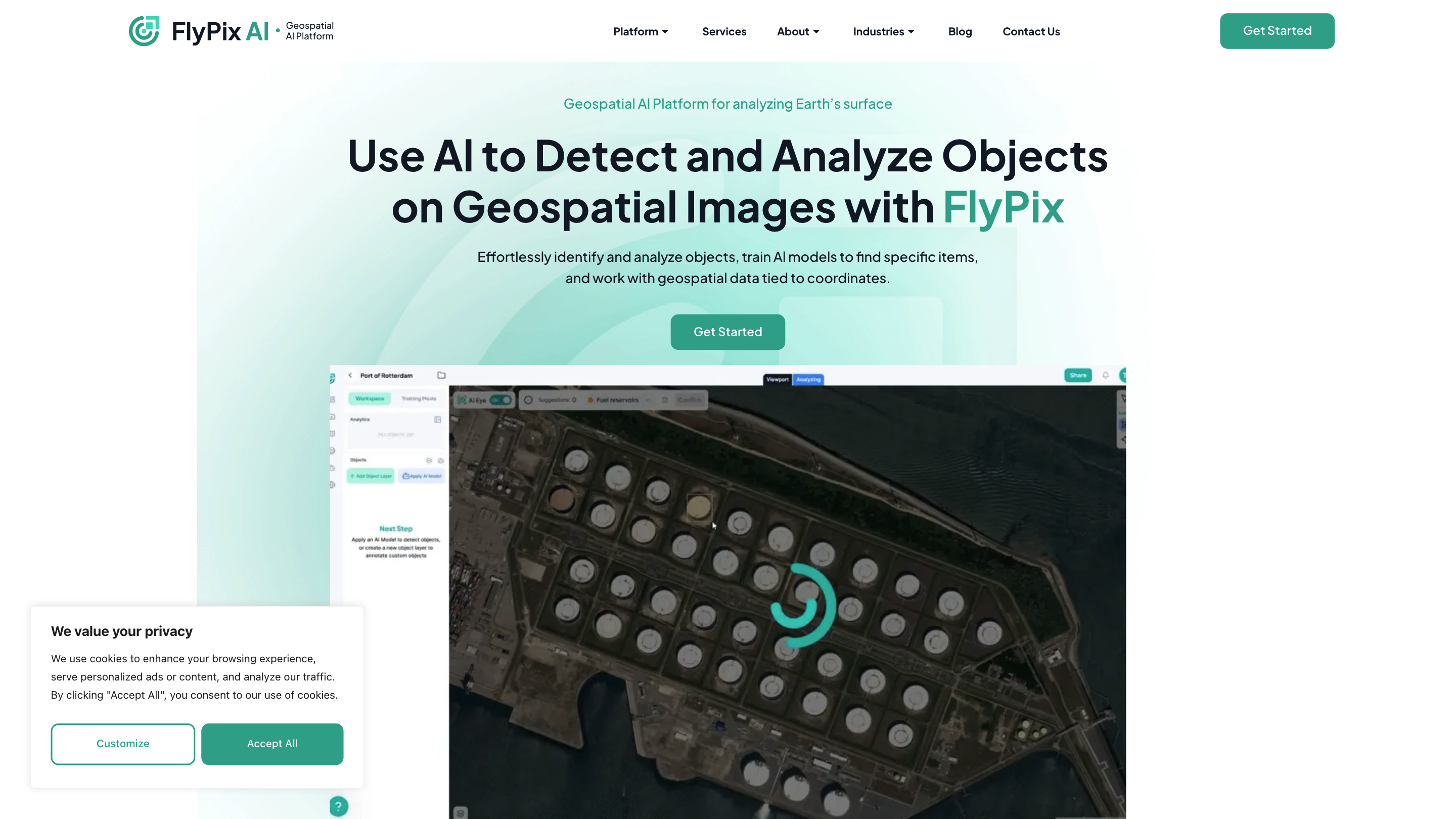
FlyPix AI is a geospatial AI platform designed to analyze Earth’s surface by enabling users to detect and analyze objects on geospatial images. The platform lets users train custom AI models, annotate data, and work with geospatial data tied to coordinates. It emphasizes rapid object identification and outlining in complex scenes, making it suitable for diverse industries that rely on precise geospatial analysis.
How It Works
- Use the interactive sandbox to explore FlyPix: select any object on the map, click “Find Similar,” and observe how the platform identifies and outlines matching objects.
- Train custom AI models using user-defined annotations to detect any objects visible in images or rasters, tailored to specific needs.
- Access analytics dashboards and AI model capabilities to predict/detect objects across geospatial imagery.
Core Capabilities
- AI-driven object detection and outlining on geospatial images
- Trainable AI models with user-defined annotations
- Works with geospatial data tied to coordinates
- Interactive sandbox for rapid experimentation
- Analytics dashboards for monitoring AI model performance
- AI-powered geospatial object detection and outlining
- Train custom AI models without deep AI knowledge
- Interactive sandbox for quick try-outs (Find Similar)
- Coordinate-tied geospatial data support
- Analytics dashboard access
- Support for industry-specific workflows (construction, port operations, agriculture, infrastructure, forestry, government, ecotechnology)
- Multispectral data support in pricing plans
- API access and collaboration options in higher plans
Industries Benefiting from FlyPix
- Construction
- Port Operations
- Agriculture
- Infrastructure Maintenance
- Forestry
- Government
- Ecotechnology
- Mining
- Smart City
Get Started and Pricing
- Start your free trial to explore the platform and its capabilities.
- Pricing plans (EUR):
- Basic (Starter): Free / 1 user, Storage 3GB, 10 Credits, AI Model training and predictions, Analytics dashboard, Email support, Multispectral data support
- Starter: €50 / 1 user, Storage 10GB, 50 Credits monthly, 1 Gigapixel processing, AI model training, predictions, analytics, email support, Multispectral data
- Standard: €500 / 2 users, Storage 120GB, 500 + 100 Credits, 12 Gigapixels processing, analytics, email support, collaboration, vector layer export, map sharing, Multispectral data
- Professional: €2000 / 5 users, Storage 600GB, 2000 + 1000 Credits, 60 Gigapixels processing, analytics, priority email support, collaboration, map publishing, export vector layer, advanced access control, API, White label, Multispectral data
- Plans include options for API access, collaboration, vector exports, map sharing, and advanced data handling features. Prices and features may vary by plan and region.
How to Use FlyPix
- Create an AI model: Define annotations on your imagery to train the model to detect specific objects.
- Run detections: Apply trained models to geospatial images to identify and outline objects of interest.
- Review analytics: Use the analytics dashboard to monitor model performance and refine annotations as needed.
- Collaborate: Use plan features to share maps, export vector layers, and manage access for teams.
Safety and Compliance
- FlyPix emphasizes enterprise-grade capabilities with data handling suitable for geospatial applications. Users should ensure proper use in compliance with relevant laws and regulatory requirements for geospatial data.
About FlyPix
- FlyPix AI GmbH is based in Darmstadt, Germany, offering a suite of AI-driven geospatial analysis tools designed to save time and increase accuracy when processing large, complex geospatial datasets.