LocaleScan
Open siteBusiness Research
Introduction
Real estate area overview platform
LocaleScan Product Information
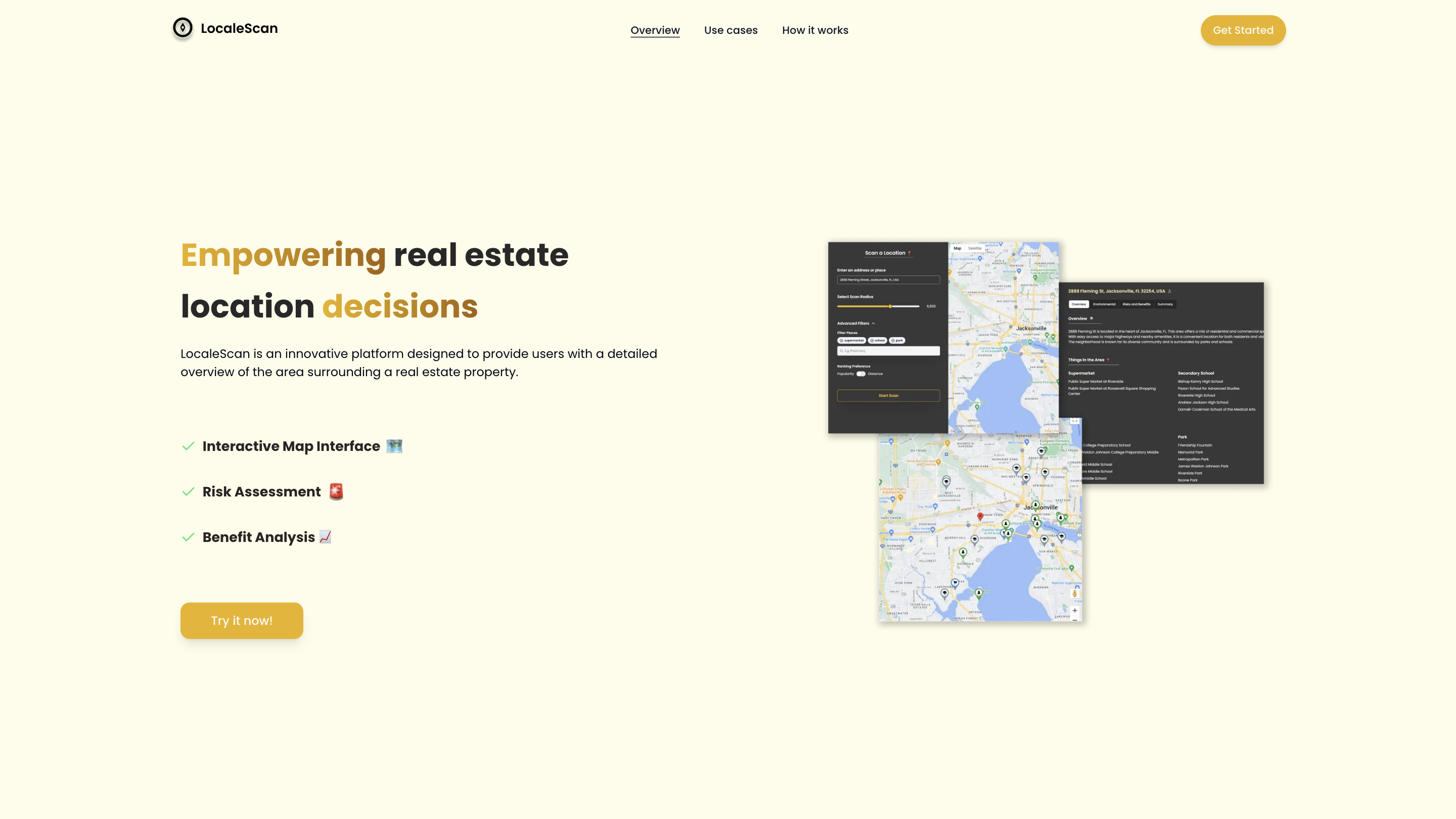
LocaleScan: Empower Your Real Estate Decisions is an AI-powered platform that provides a detailed, location-centric overview of the area surrounding a real estate property. It combines an interactive map interface with risk assessment and benefit analysis to help buyers, renters, investors, agents, urban planners, and developers make informed decisions about neighborhoods and properties.
How to Use LocaleScan
- Specify a location to analyze. Enter an address, neighborhood, or coordinates to center the map on the area of interest.
- Define a scan radius. Choose the radius to capture relevant nearby amenities, risks, and opportunities.
- Explore results on the interactive map. Zoom, pan, and toggle layers to view markers, risk metrics, and benefit indicators tailored to your needs.
What You’ll See
- Interactive Map Interface: A user-friendly map with zoom controls and layered information.
- Customizable Markers: Distinct icons for different place types (e.g., schools, hospitals).
- Risk Assessment: Up-to-date crime rates, environmental hazards, noise and pollution levels, and proximity to industrial sites.
- Economic Stability: Local economic health metrics such as unemployment rates and growth opportunities.
- Benefit Analysis: Nearby amenities (restaurants, cafes, shopping, gyms, entertainment), education and childcare options, and overall quality of life indicators.
Use Cases
- Home Buyers: Assess safety, convenience, and overall suitability before purchasing.
- Renters: Compare neighborhoods based on location-specific pros and cons.
- Real Estate Investors: Identify high-potential areas and mitigate locations with significant risks.
- Real Estate Agents: Provide clients with data-driven insights on potential properties.
- Urban Planners and Developers: Understand current conditions and potential development challenges.
How It Works
- Step 1: Specify a location to analyze.
- Step 2: Define a scan radius.
- Step 3: View the results and insights to support decision-making.
Features
- Interactive, zoomable map with layered data for real estate analysis
- Customizable markers for different nearby amenities and facilities
- Comprehensive risk assessment (crime, environmental hazards, proximity to hazards)
- Economic and opportunity indicators (local economy, growth potential)
- Benefit analysis of nearby services and educational options
- Intuitive UI tailored for home buyers, renters, investors, and professionals
- Quick highlight of neighborhoods with high-potential prospects and low risk