Mappedin
Open siteInterior & Architectural Design
Introduction
Create indoor maps with AI-powered tools.
Mappedin Product Information
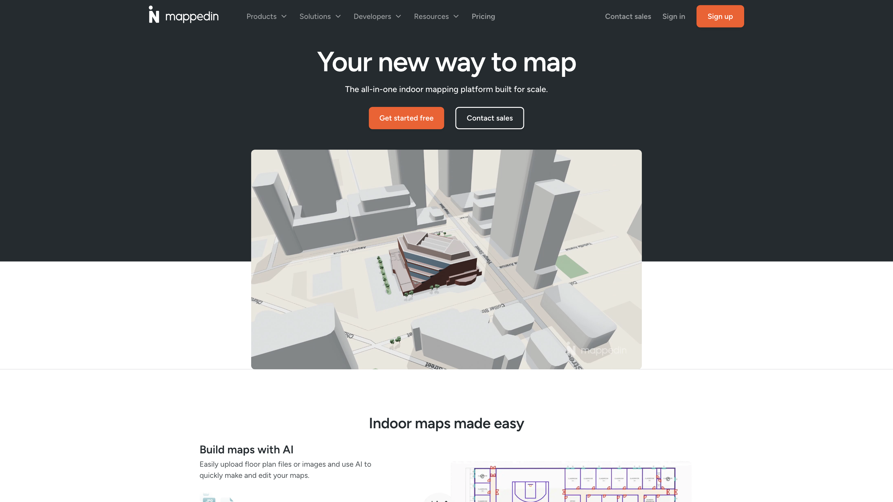
Mappedin — Indoor Mapping Platform for Scale
Mappedin is an all-in-one indoor mapping platform designed to simplify building, publishing, and managing interactive 3D indoor maps at scale. It enables rapid map creation from floor plans or images, AI-assisted edits, real-time navigation, rich content enrichment, and cross-platform publishing. The platform targets enterprises and developers who need immersive wayfinding, asset tracking, and integrated indoor experiences across airports, events, workplaces, stadiums, and malls.
How to Use Mappedin
- Build maps with AI: Upload floor plan files or images and use AI to quickly create and edit your maps.
- Automate navigation: Enable real-time indoor navigation with every map you publish.
- Add map content: Flexibly enrich maps with features, labels, and more to fit your use case.
- Publish: Share interactive 3D maps across formats and devices instantly.
- Manage and update: Continuously update map content and republish with the latest information.
Features
- AI-assisted map creation and editing from floor plans or images
- Automatic indoor navigation with every map
- Flexible content enrichment (labels, features, data layers, etc.)
- Instant publishing of interactive 3D maps across formats and devices
- Real-time collaboration for teams (Plus and Pro plans)
- Versioned updates and easy content management
- Cross-platform delivery: web, mobile, kiosks, and SDK integrations
- Real-time data integrations for dynamic experiences (e.g., flight data, security wait times)
- Developer-friendly tools and SDKs for custom builds
Plans and Collaborations
- Plus and Pro plans offer advanced mapping capabilities including real-time collaboration.
- Multiple solutions for enterprises across airports, events, workplaces, stadiums, and malls.
- Developer tools to embed maps into websites and apps, and to export in various formats (IMDF, PDF, Shapefile, etc.).
Core Tools and Solve Areas
- Indoor Mapping and Navigation
- Real-time Data Integration (e.g., passenger flight data, wait times)
- 3D Map Viewer and Embedding
- API, SDKs, and Open Formats (GeoJSON, IMDF, etc.)
- Collaboration and Access Management
- Content Management and Publishing
- Security and Accessibility Support
Developer and Integrations
- Open standards support: GeoJSON, IMDF exports, and more
- SDK Access: Build immersive indoor experiences with comprehensive toolkits
- Web and mobile integrations: 3D map viewer, APIs, and embeds
- Exports: Export maps to IMDF, PDF, Shapefile, and additional formats
- Works with website builders and third-party apps
Map Use Cases
- Airports and transit hubs for passenger wayfinding with real-time data
- Events, stadiums, malls, and workplaces requiring scalable indoor maps
- Safety and security-focused deployments with live data
Safety and Privacy Considerations
- Real-time data integrations are configurable to respect privacy and security policies
- Content management allows controlling who can view and edit maps
How It Works
- Upload floor plans or images
- AI assists in generating and refining maps
- Enrich with content and data layers
- Publish interactive 3D maps
- Enable real-time navigation and collaboration
Get Started
- Get started free to explore basic mapping capabilities
- Sign up to access Plus/Pro features for real-time collaboration and advanced mapping
- Contact sales for tailored enterprise solutions
Quick Overview of Core Features
- AI-assisted map creation from floor plans/images
- Automated indoor navigation for all maps
- Flexible content enrichment (labels, features, data layers)
- Instant publishing of interactive 3D maps
- Real-time collaboration on Plus/Pro plans
- SDKs and APIs for custom builds
- Open export formats (IMDF, PDF, Shapefile, etc.)
- Cross-device and cross-platform map delivery